

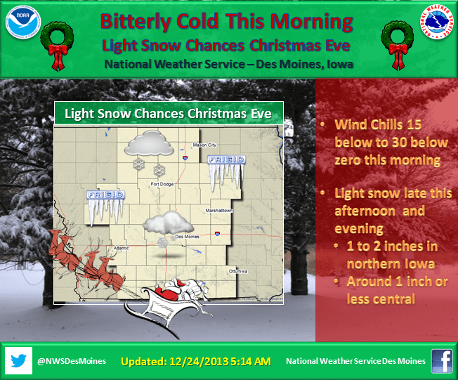
The National Weather Service reports that bitterly cold conditions will continue early this morning as temperatures dip to -10 to -20 F across the area and wind chills continue in the 15 below to 30 below range through noon today. A weak upper level disturbance will bring some light snow chances to portions of Iowa this afternoon and evening. Up to 1 to 2 inches of snow is expected, along with some wind across the northern portion of the state. Area travelers should check conditions prior to heading out late this afternoon and evening.
For Marion County, the forecast predicts a 50 percent chance of snow after 4pm today. Increasing clouds, with a high near 16. Wind chill values as low as -20. South southeast wind 5 to 15 mph, with gusts as high as 21 mph. Total daytime snow accumulation of less than a half inch possible.
Tonight snow, mainly before 9pm. Temperature rising to around 20 by 4am. Wind chill values as low as zero. South wind 10 to 14 mph becoming west after midnight. Winds could gust as high as 18 mph. Chance of precipitation is 80%. New snow accumulation of less than a half inch possible.
Christmas Day will be mostly sunny, with a high near 29. Wind chill values as low as 5. Breezy, with a west southwest wind 10 to 16 mph, with gusts as high as 23 mph.