
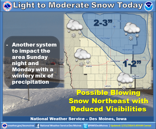
The National Weather Service says another weather system will spread snow across the Northeast two thirds of Iowa today. The far North central and Northeast portions of the state will see the heaviest snowfall with 2-3 inches possible. Lighter amounts will occur further Southwest. In addition…a Southerly wind at 10 to 20 mph could produce blowing snow with reduced visibilities…especially in open areas. Freezing drizzle is also possible late this afternoon into early evening. Another weather system will affect the area late this weekend and Monday. Temperatures will warm enough for this system to produce a wintery mix of precipitation including freezing rain, sleet and snow. The active weather pattern will remain over the region with chances for precipitation about every 48 hours.