
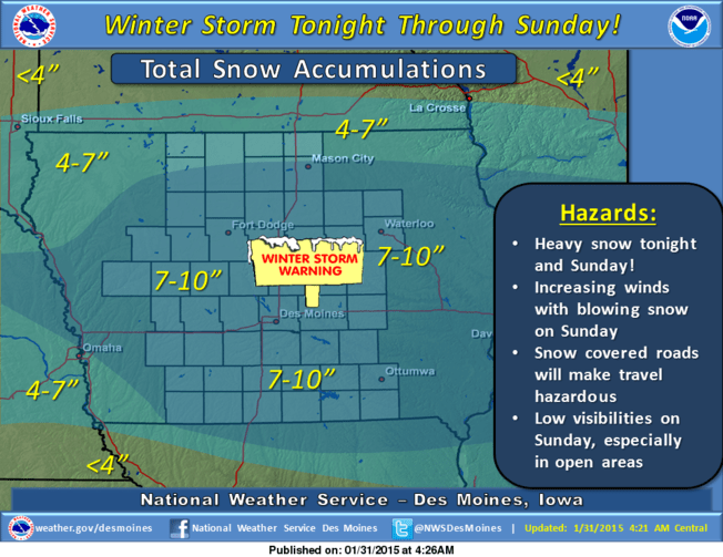
Significant snowfall is expected in Marion County and throughout much of the state today.
According to the National Weather Service 7 to 10″ of snow is expected to fall through Sunday afternoon, with heavier amounts possible depending on the track of the storm. Rain is expected to start in the afternoon hours and change over to mixed precipitation and eventually snow by the evening.
Winds are expected to gradually increase beginning late this evening into Sunday, with expected maximum sustained winds as high as 15 – 20 MPH and gusts up to 30 MPH over much of the state.
Temperatures are expected to drop Sunday night into Monday, and when combined with the increased winds, will result in dangerous wind chill values as low as -5° to -15°. Exposure to these wind chills will result in frost bite in as little as 30 minutes.