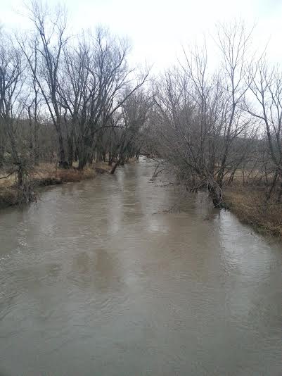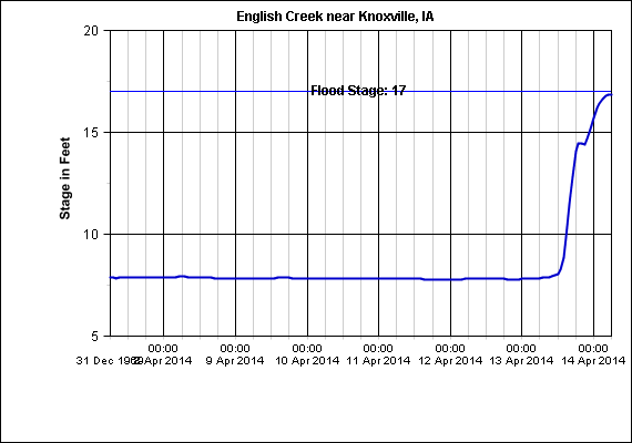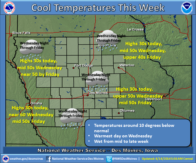
Knoxville received 2.84 inches of rain yesterday. A flash flood watch was temporarily in effect for Marion County and surrounding areas. Creeks and rivers rose, and English Creek, south of Knoxville was approaching flood stage Monday morning, rising almost 9 feet in 24 hours. The much needed moisture brought with it cooler temperatures also, and according to the National Weather Service, the upper Midwest will be under the influence of a Northwest flow which will keep cool temperatures in place across Iowa. A low pressure system will pull warmer air across the state on Wednesday but that will be short lived as an upper level trough of low pressure drives the low east and allows colder air to move back in. The combination of the surface low and the upper level system moving slowly to the East will keep precipitation chances in Iowa from Wednesday night through Friday.