
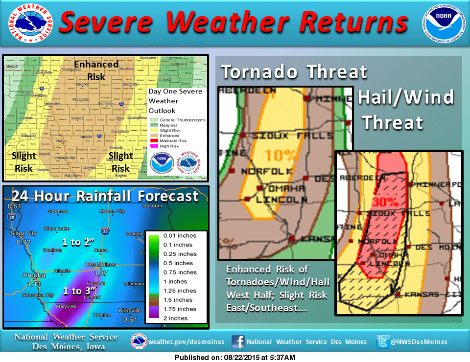
Strong thunderstorms are expected along a cold front passing through the state late this afternoon. There is a slight risk of severe weather for much of the area, and an enhanced risk to the west.
Initially, thunderstorms will develop over northwest Iowa between noon and 3 pm and strengthen through 6 pm. The storms are likely to then form a line, with strong winds and heavy rainfall becoming more likely into the evening hours. The greatest threat for tornadoes will be along and west of I35.
The greatest threat for large hail and damaging thunderstorm winds will extend east of I35, including Marion County. Heavy rain of up to 3 inches is possible from 7 pm and 11 pm. Stay tuned to KNIA/KRLS for the latest weather information.