
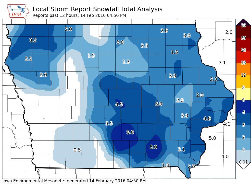
Marion County received approximately five inches of snow overnight Saturday and Sunday.
A weak impulse will cut across portions of western and southern Iowa tonight, which may bring a dusting of light snow. Another quick moving low pressure system is expected to push south into the area Monday night. This system will bring additional snowfall, with around 1 to 2 inches of additional snow possible. Looking ahead to the end of the work week, temperatures will warm, with above normal temperatures expected by Thursday into Friday. Runoff from the snowmelt will result in significant within-bank rises–and potential minor flooding–along area streams later this week into this weekend especially north of Interstate 80. In addition, ice jams are also possible along rivers north of US Hwy 30 where more river ice is in place.
The Iowa Department of Transportation reports that area roadways are partially snow and ice covered and may be slick. There were reports of vehicles in ditches overnight. State and county plows are out. If you must travel this morning, take extra time to get to your destination, and give our road crews and first responders plenty of room to work.