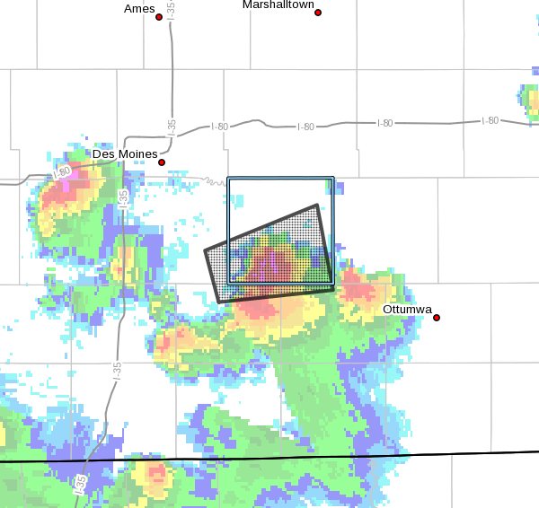
Large hail prompted three severe thunderstorm warnings in the southern-half of Marion County Thursday night.
The KNIA/KRLS Severe Weather Action Team was on the air at 9 p.m. for the first of three warnings issued. KNIA/KRLS had five staff members on-the-air and receiving damage reports, and also received live updates from the WeatherEye Weather Center and trained weather spotters near Tracy. A fourth storm warning was issued for northwestern Marion County just after 10:40 p.m., and live Severe Weather Action Team coverage resumed soon thereafter.
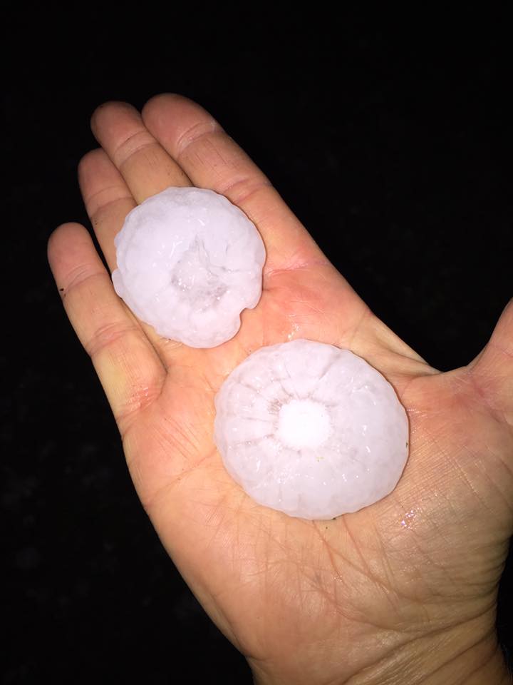
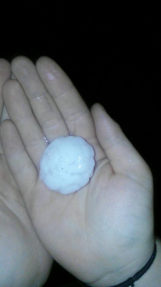
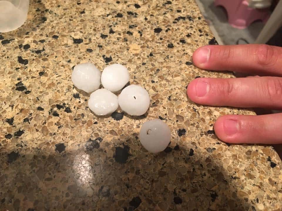
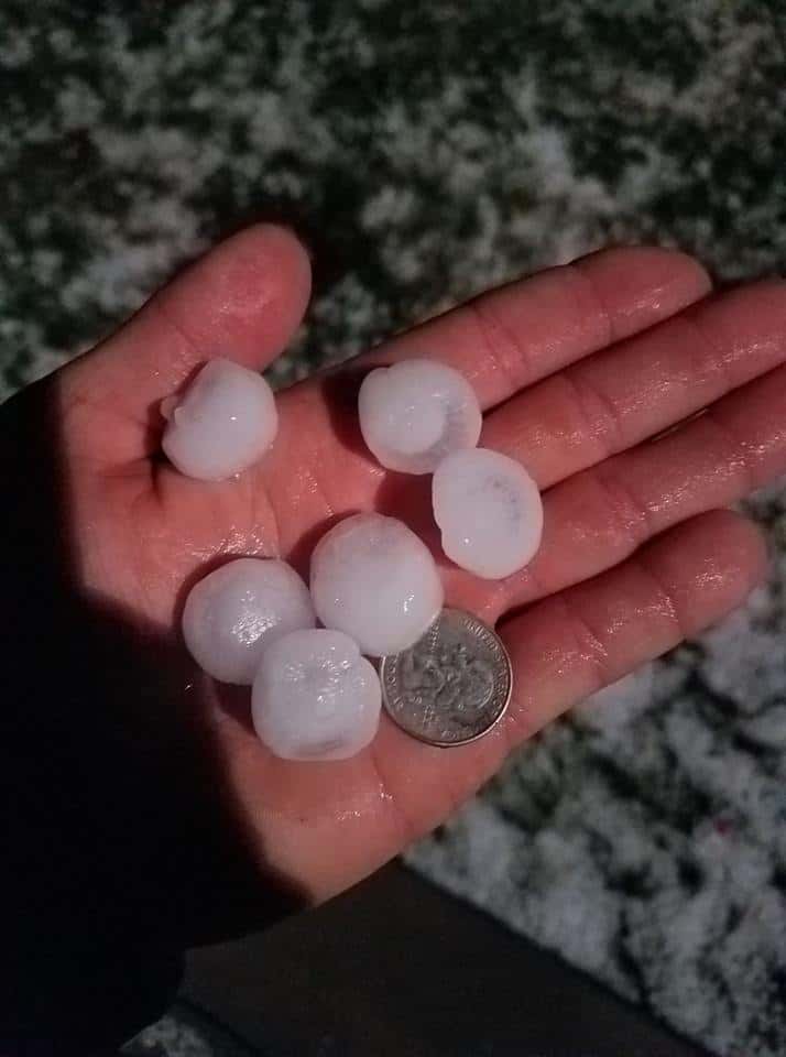
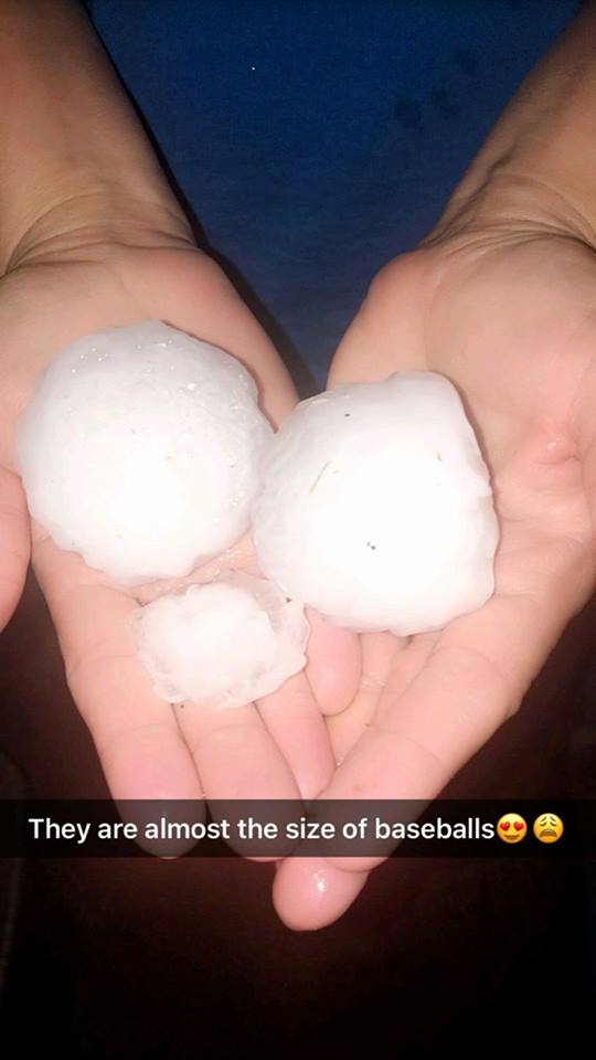
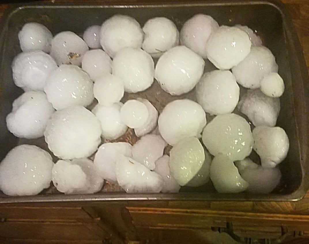
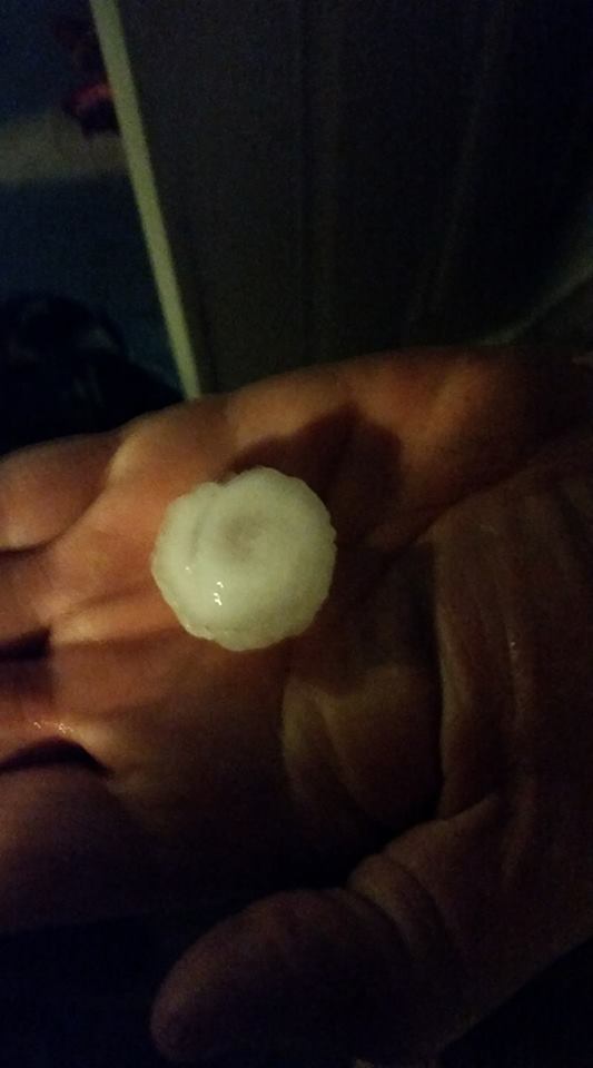
Numerous reports of hail were reported, including baseball sized hail five miles east of Melcher-Dallas at around 9:30 p.m. by law enforcement. Large hail was also spotted in Melcher-Dallas, Attica, Tracy, Hamilton, Bussey, and Lovilia, as well as Otley with the later storm. Windows and sky lights were reportedly blown out numerous homes south of Knoxville. Tree and car damage was also spotted by law enforcement near Melcher-Dallas.
Storms possible over the next two days may produce more severe weather as they pass through the area. The National Weather Service Storm Prediction Center has issued an enhanced risk of severe weather Friday and a slight risk Saturday.
The KNIA/KRLS Severe Weather Action Team will go on the air live during any Severe Thunderstorm or Tornado Warning for any portion of Marion County, and backup generators that automatically come on if we lose power ensure our coverage stays on if the power goes out.
The Marion County Emergency Management department is seeking any possible damage reports. Email janderson@co.marion.ia.us with address information and any photos of damage.
Photos from listeners: