Due to rising lake levels the South Overlook Boat Ramp and Volksweg Trail near the Red Rock Marina have been closed.
Whitebreast Beach has now been closed as well. Parking at the Marina Cove is very limited due to the high lake level. There is a moderate amount of floating debris in the lake, and the U.S. Army Corps of Engineers reminds everyone to use caution while boating.
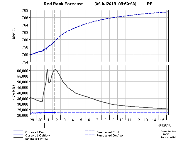
Today, the levels have risen to above 761 feet above sea level and inflows will exceed 40,000 cubic feet per second. The lake is expected to crest at 767 feet by the middle of this month. Approximately 32% of the lake’s flood storage capacity is being used, and is at 742 feet during normal conservation pool.
For additional information, please contact the US Army Corps of Engineers at 641-828-7522 or online at www.lakeredrock.org.
Several Marion County roads have been closed due to flooding.
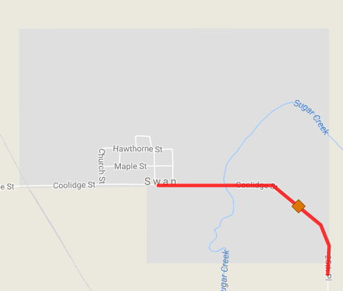
Coolidge St. near Swan, Sugar Creek
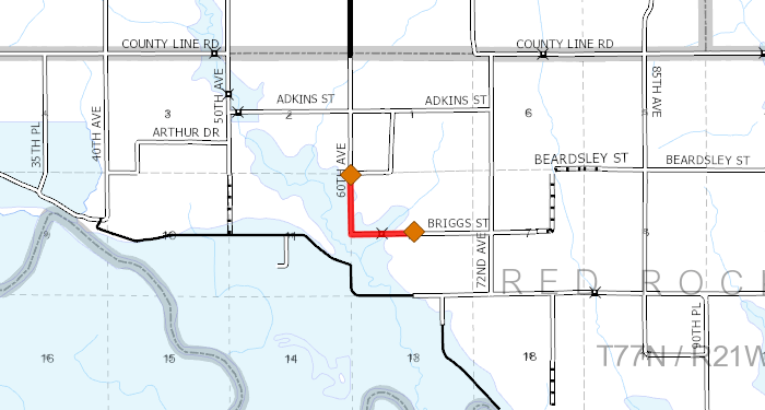
Portions of 60th Ave and Briggs St.
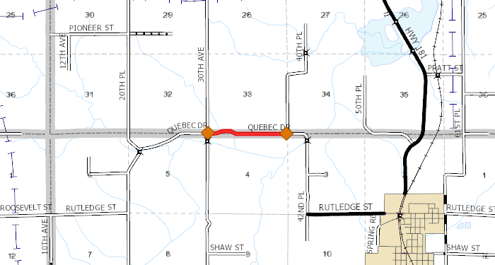
A portion of Quebec Dr
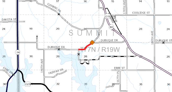
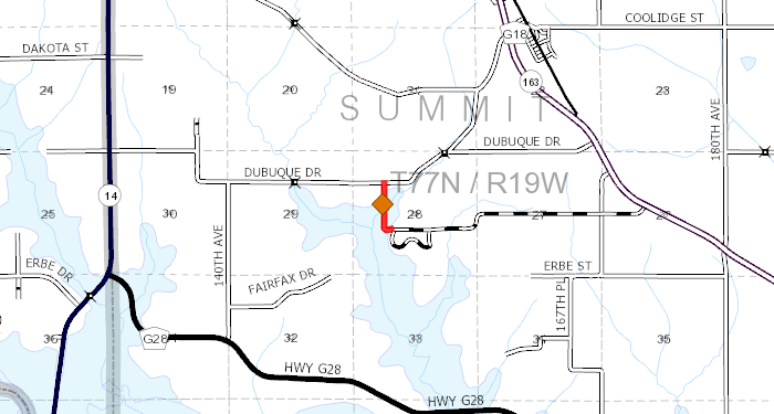
Dubuque Drive southwest of Highway 163
Beardsley Dr. between 25th and 35th will be closed indefinitely until emergency repairs can be made to a culvert that has washed out.
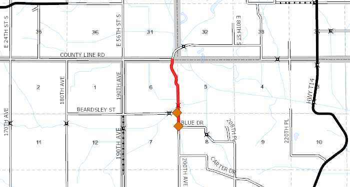
200th Ave between Blue Dr. and County Line Road
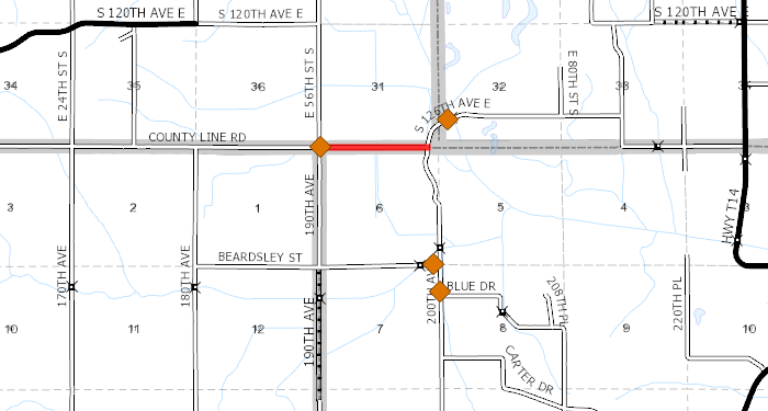
County Line Road between 190th and 200th Ave

Kennedy St. between Highway S71 and 150th Ave
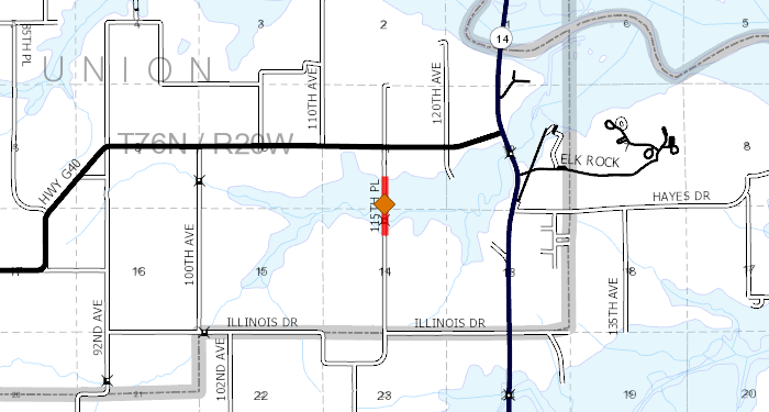
115th Place between Illinois Dr and Highway G40
Elk Horn Drive from Park Hill subdivision to Dubuque Dr.
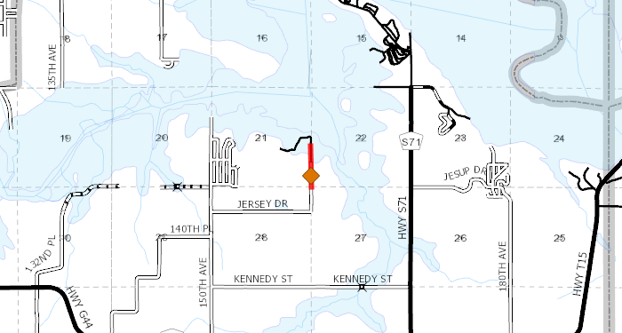
160th Ave from Jersey Dr. North to Lake Red Rock.
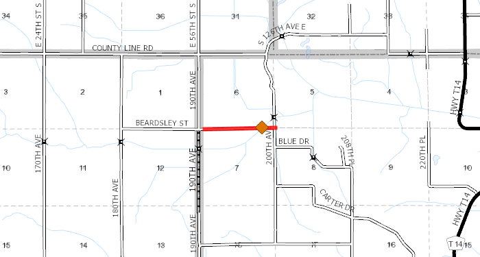
Beardsley between 190th and 200th.