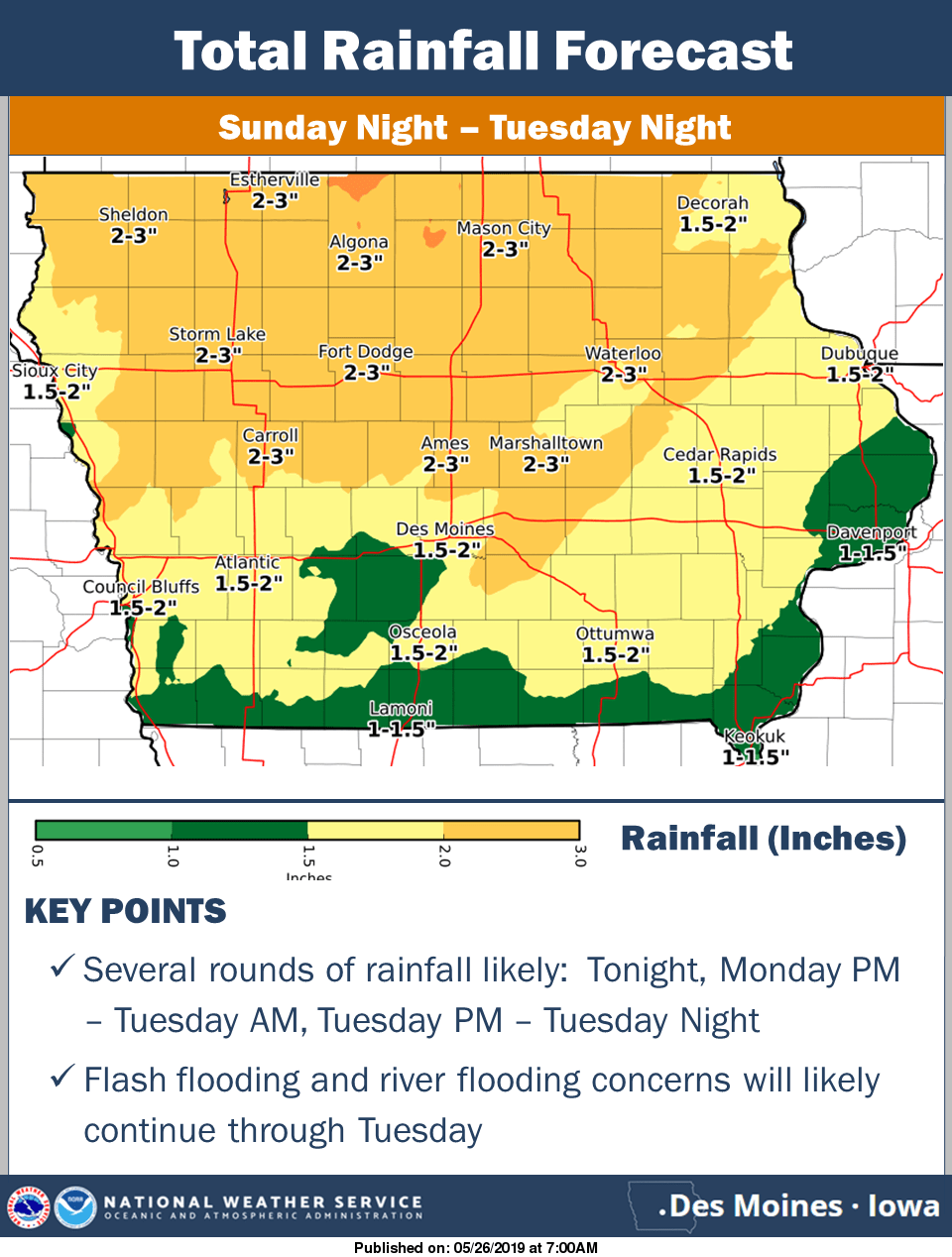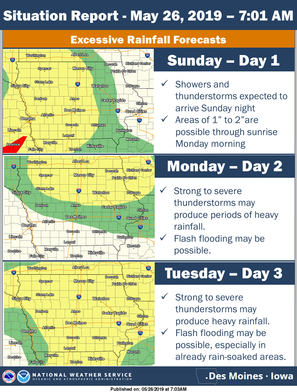

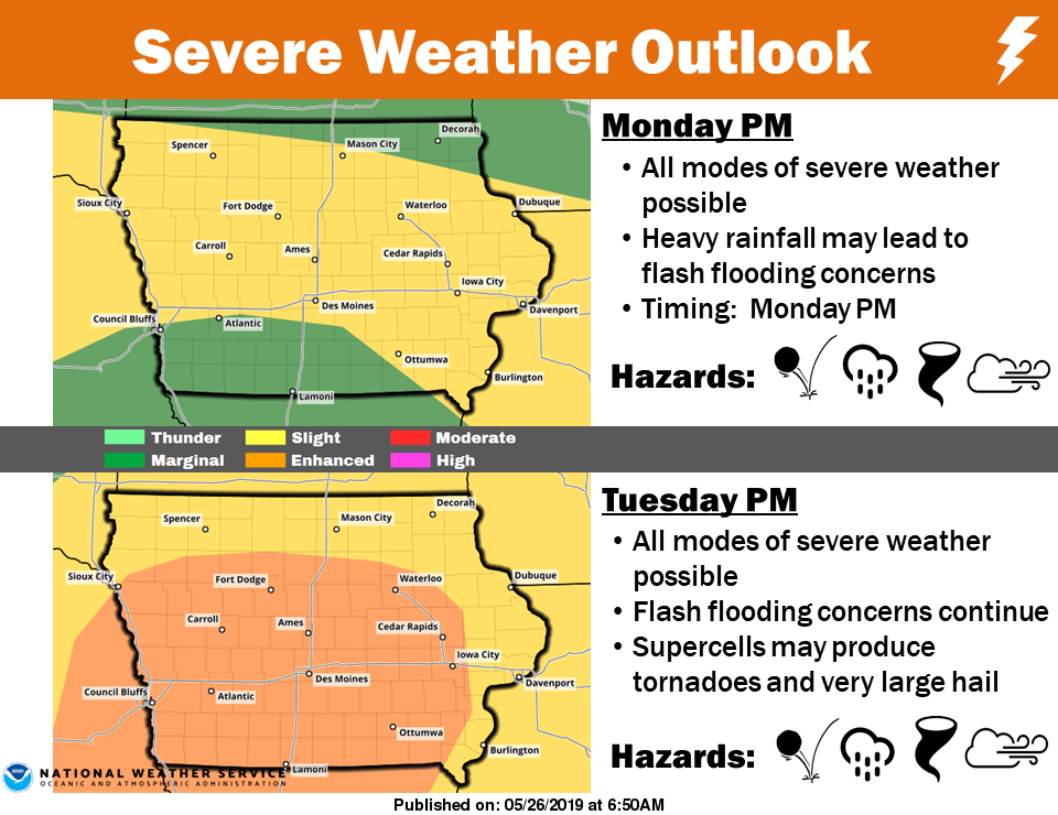
After more rainfall fell late Saturday into Sunday morning, increased chances for strong thunderstorms are in the forecast late Sunday through Tuesday evening. The National Weather Service Storm Prediction Center has issued a slight risk Monday and an enhanced risk for Tuesday as it relates to the chances for severe thunderstorms. Damaging winds and hail are the primary threats Monday. More organized severe thunderstorms are possible Tuesday, with tornadoes, large hail, and damaging winds all possible. Heavy rainfall could also cause localized and flash flooding as well, with another 1-2″ of rain in the forecast, with higher amounts possible depending on the track and strength of thunderstorms. Several rain gauges in south central Iowa have seen anywhere between 5 to 8 inches of precipitation over the past two weeks. Stay tuned to KNIA/KRLS for the latest severe weather information, with live coverage for any severe thunderstorm or tornado warning for any portion of Marion and Warren Counties.
Rainfall from Saturday at 7 p.m. through 10 a.m. Sunday:
Pella (KNIA/KRLS – .72″ (6.5″ since May 1st)
Knoxville (KNIA/KRLS) – 1.13″ (6.29 since May 1st)
Lake Red Rock – .89″ (4.41 since May 16th)
Middle River near Indianola – .48″ (6.61 since May 16th)
South River near Ackworth – .75″ (6.36 since May 16th)
Whitebreast near Melcher – .91″ (5.1 since May 16th)
English Creek near Knoxville – 1.18″ (5.37 since May 16th)
Cedar Creek near Bussey – .53″ (4.48 since May 16th)
Des Moines River near Swan – 1.21″ (4.74 since May 18th)