

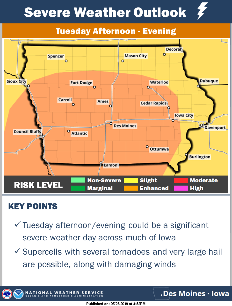
The KNIA/KRLS Severe Weather Action Team was active again over the holiday, this time for a strong thunderstorm in the morning. A warning was issued for western Marion and eastern Warren Counties for a fast moving line of severe thunderstorms from 6:50 to 7:15 a.m. Three staff members contributed to on-air coverage, with updates from Weatherology meteorologists. Increased chances for strong thunderstorms are in the forecast through Tuesday evening. The National Weather Service Storm Prediction Center has issued a slight risk today and an enhanced risk for Tuesday as it relates to the chances for severe thunderstorms. A more organized system is possible Tuesday, with tornadoes, large hail, and damaging winds all possible. Heavy rainfall could also cause localized and flash flooding as well, with another 1-2″ of rain in the forecast through Wednesday morning, with higher amounts possible depending on the track and strength of thunderstorms. Several rain gauges in south central Iowa have seen anywhere between 4 to 7 inches of precipitation since the middle of May. Stay tuned to KNIA/KRLS for the latest severe weather information, with live coverage for any severe thunderstorm or tornado warning for any portion of Marion and Warren Counties.