

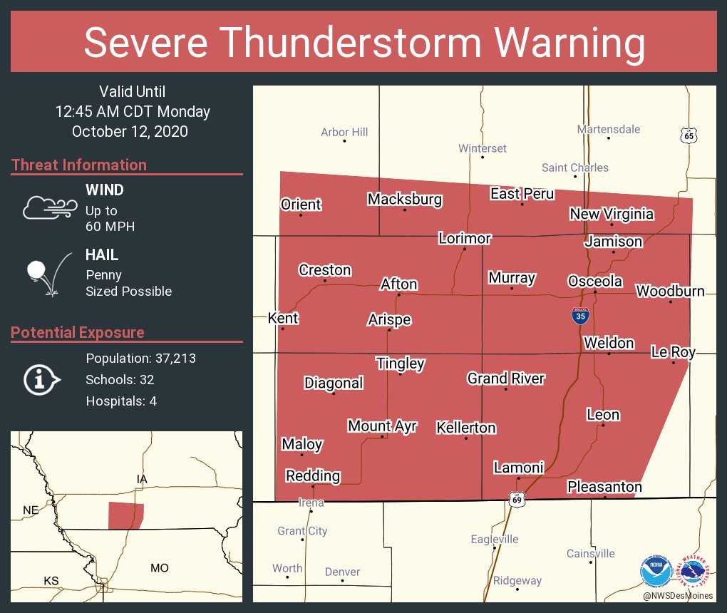
A cold front passing through the area produced a brief severe thunderstorm warning in southwestern Warren County and other areas of south central Iowa. The KNIA/KRLS Severe Weather Action Team was on the air from midnight to 12:45 for a strong line of wind passing through ahead of showers and thunderstorms. The storm had weakened to below severe limits before impacting Warren and Marion Counties.
Temperatures are expected to stay in the 70s in the afternoon Tuesday and Wednesday, before a fall cool down is expected — and daytime highs will remain in the 50s for the foreseeable future, with little to no rainfall expected throughout the rest of the month, according to the National Weather Service Climate Prediction Center.
The KNIA/KRLS Severe Weather Action Team is on the air for any severe thunderstorm or tornado warning for any portion of Marion and Warren Counties, with backup generators ensuring the coverage stays on if the power goes out.
‘