

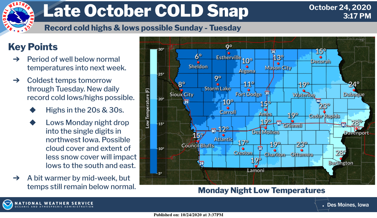
It will feel a lot more like winter through Tuesday night as an abnormally cold burst of air dominates the region.
Daytime highs in the mid-to-upper 30s and overnight lows into the 20s will approach long-standing records for cold in Marion County and the surrounding area.
While a snow squall on October 19th provided the first measurable frozen precipitation of the 2020-21 season in Polk and Jasper Counties, those who did not see the white stuff stick could see the first measurable amount overnight Sunday into early Monday morning.
Traditionally, the first inch of snow in south central Iowa doesn’t typically fall until the last week of November or first week of December. The National Weather Service predicts up to 1” of snow is possible in the region, especially in Warren and Polk Counties. No major travel hazards are anticipated at this time locally.
Wind chills will feel frigid Monday and Tuesday morning, as the air will feel like it’s in the teens. More mild conditions return by Wednesday, with daytime highs approaching 50 and warming up into the weekend.
Stay tuned to KNIA/KRLS for the latest weather information.