
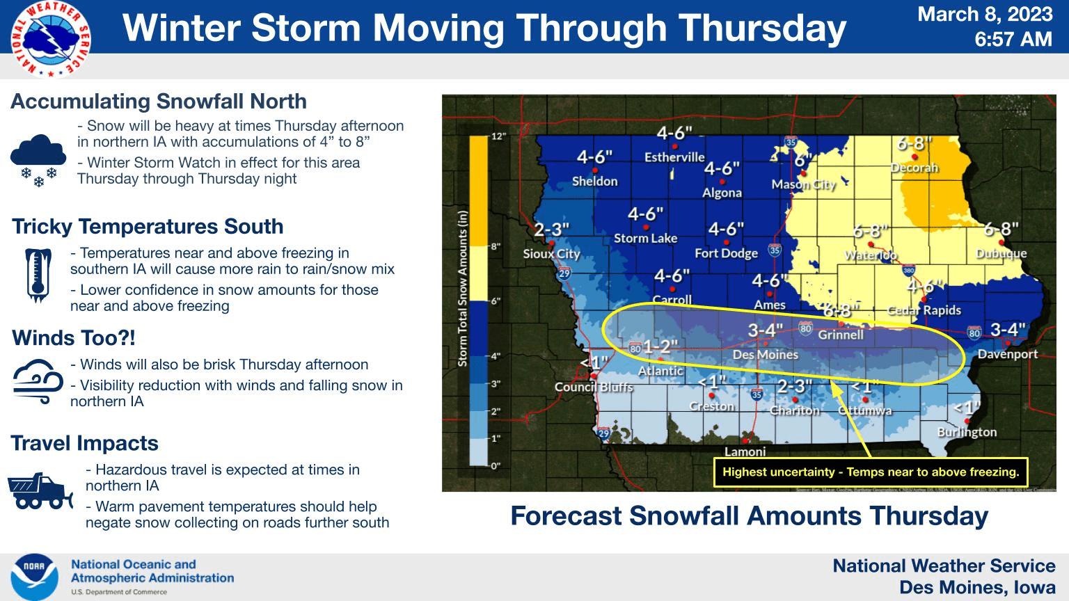
A winter storm is expected to impact the area throughout the day today, with moderate to heavy snow accumulations of 4 to 8 inches possible in the northeastern portion of the state.
According to the National Weather Service, warm surface temperatures locally will promote a change over to rain or rain/snow mix. The lowest confidence in snowfall amounts runs north of and along the I-80 corridor where temperatures will be near to just above freezing with the greatest variation in rain/snow.
For those with heavier snowfall, travel may become hazardous and visibility reduced at times. Warm pavement temperatures further south should help negate snow accumulation on roads but travel impacts are still possible. This system will depart the area by tomorrow morning.