
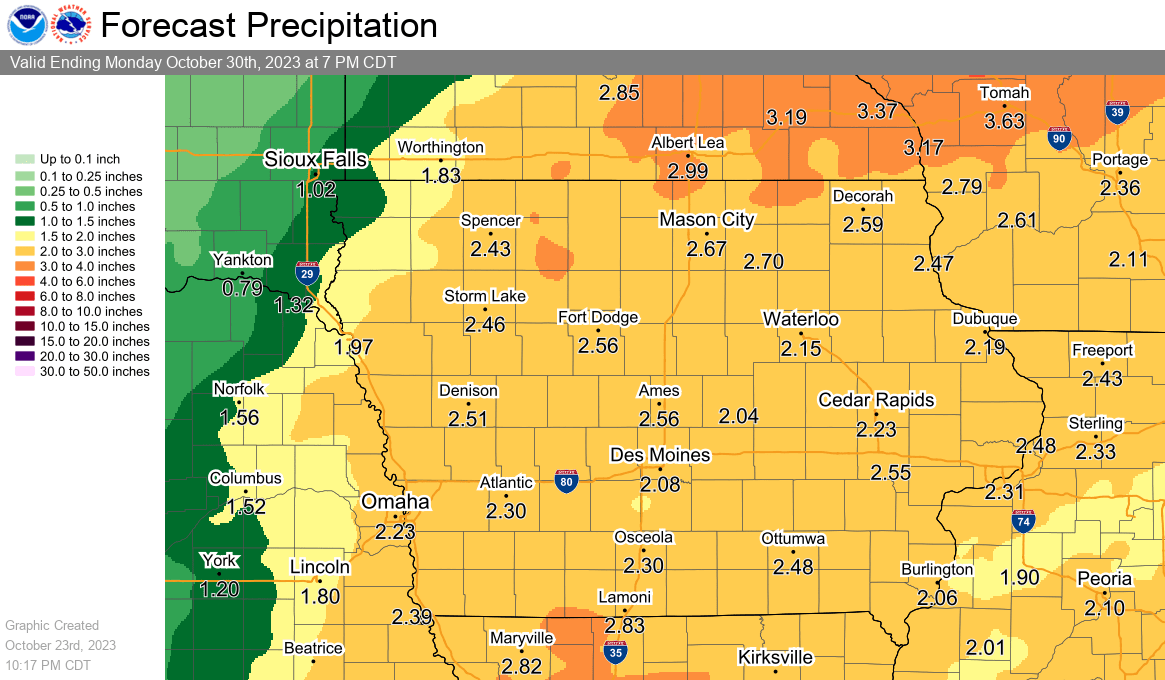
Multiple rounds of rain remain possible over the next several days, before eventually giving way to a major cooldown by the end of the week. According to the National Weather Service, several chances for periodic showers and some thunderstorms may bring needed precipitation to areas hit hard by the ongoing drought. While not a total washout during the week with several dry periods expected, many locations may receive 1-3″ of rainfall by Sunday night.
Temperatures are expected to stay well above average through Thursday with afternoon highs in the 70s, before a significant shift to much cooler weather begins by Friday. A gradual daily cooldown will drop thermometers into the 40s by the weekend during the day, with the first hard freeze of the season possible overnight Sunday into Monday. A chilly end to October will have trick-or-treating this weekend into Tuesday done in below average temperatures, with overnight lows dropping into the 20s for most of next week.