

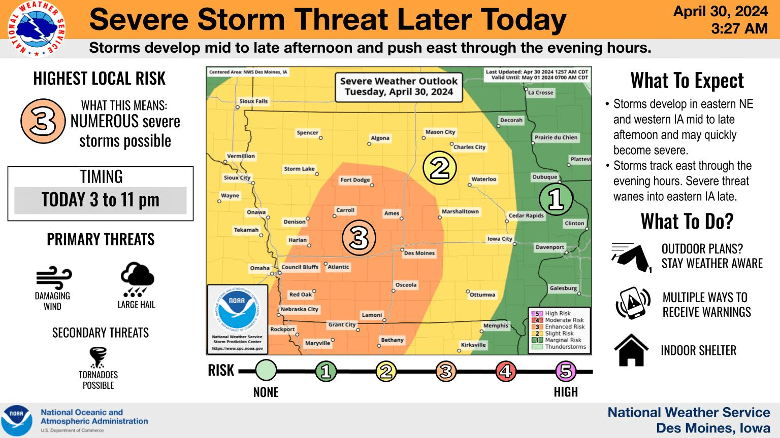
An enhanced risk for severe weather is in place late this afternoon and evening across south central Iowa. The National Weather Service Storm Prediction Center has issued a three on their scale of five for threats, which includes the potential for large hail in excess of two-inches in diameter and damaging winds above 70 MPH. Regardless, storms that pass through with a cold front should also provide brief, torrential downpours, which could add to a week of possibly heavy rainfall. The next best chances for precipitation will start Wednesday evening and continue through most of the day Thursday, with most locations expected to receive at least 1.5″ or more during the three-day span. The KNIA/KRLS Severe Weather Action Team is on the air for any severe thunderstorm or tornado warning for Marion and Warren Counties.