

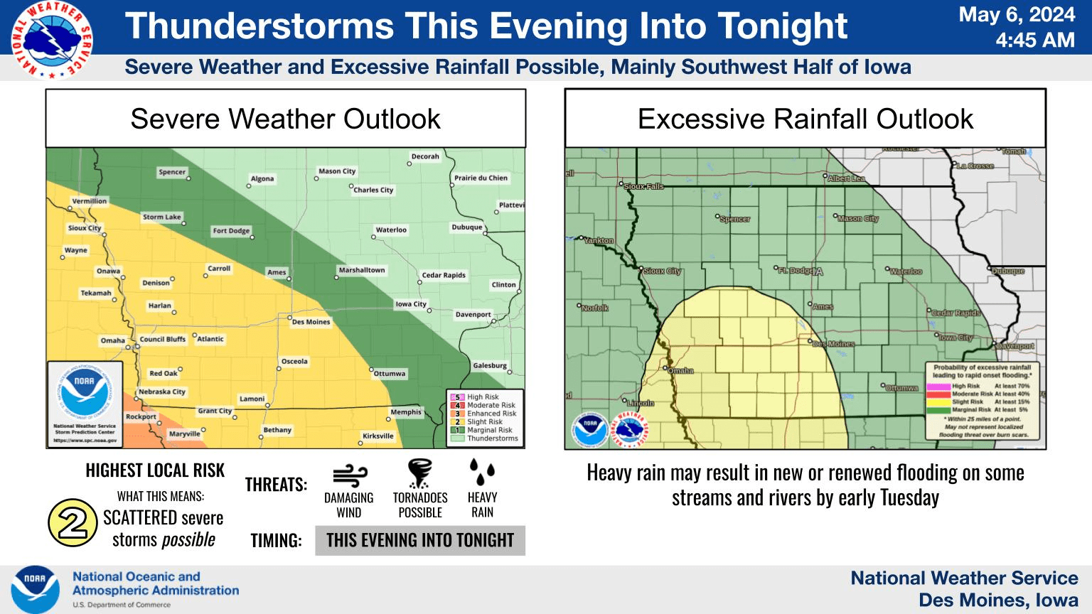
Thunderstorms will move from Nebraska into western Iowa latte this evening, then eastward across the state through Tuesday morning. There will be a risk of severe weather, primarily in the form of damaging wind gusts but with tornadoes also possible, along with heavy rainfall. These threats will be highest over the western and southwestern half of Iowa. In the coming days thunderstorm chances are also forecast Wednesday and Thursday, but any severe weather threat during that time will be lower. Daily highs through the remainder of the week will range in the 60s to mid 70s.