
Rounds of thunderstorms today could produce heavy rain and severe weather in south central Iowa.
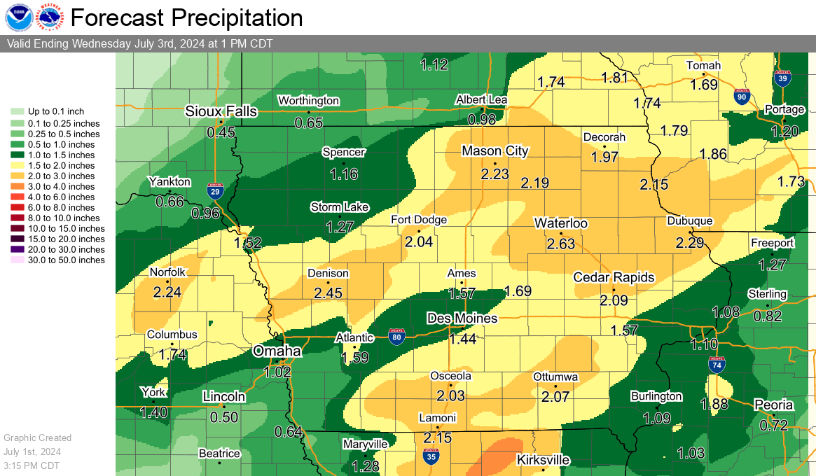
According to the National Weather Service, most locations should receive 1-2″ of precipitation by Wednesday morning, with what could be multiple chances for storm activity — and a possibility that some locations receive more than three inches of rainfall in that timespan.
Marion and Warren Counties are on the border of a slight and enhanced risk of severe weather from the Storm Prediction Center, with large hail, strong winds, and isolated tornadoes possible. The best chances for storms locally will be late this afternoon into the evening. The KNIA/KRLS Severe Weather Action Team is on the air for any severe thunderstorm or tornado warning in Marion and Warren Counties.