
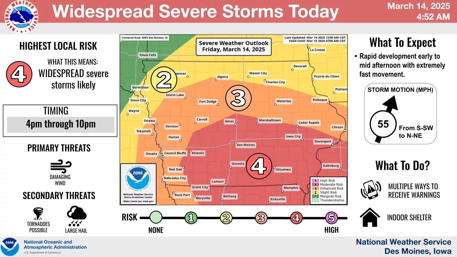
Multiple weather threats will impact the area today, according to the National Weather Service. A warm, dry day with near-record highs and gusty southern winds will result in critical fire conditions locally. Any outdoor burns have the potential to spread rapidly, and a Red Flag Warning has been issued for this afternoon and early evening.
That will be followed by potentially powerful severe weather late this afternoon and into the evening. A moderate risk, or a four out of five on the Storm Prediction Center’s scale, is in place across the southern half of the state. A line of severe thunderstorms moving from the southwest to northeast will include damaging winds as the primary threat, with large hail and a few tornadoes also possible. Some storms may produce wind gusts in excess of 70 mph.
The KNIA/KRLS Severe Weather Action Team is on the air with live coverage of any severe thunderstorm or tornado warning in Marion, Warren, and Jasper Counties.