
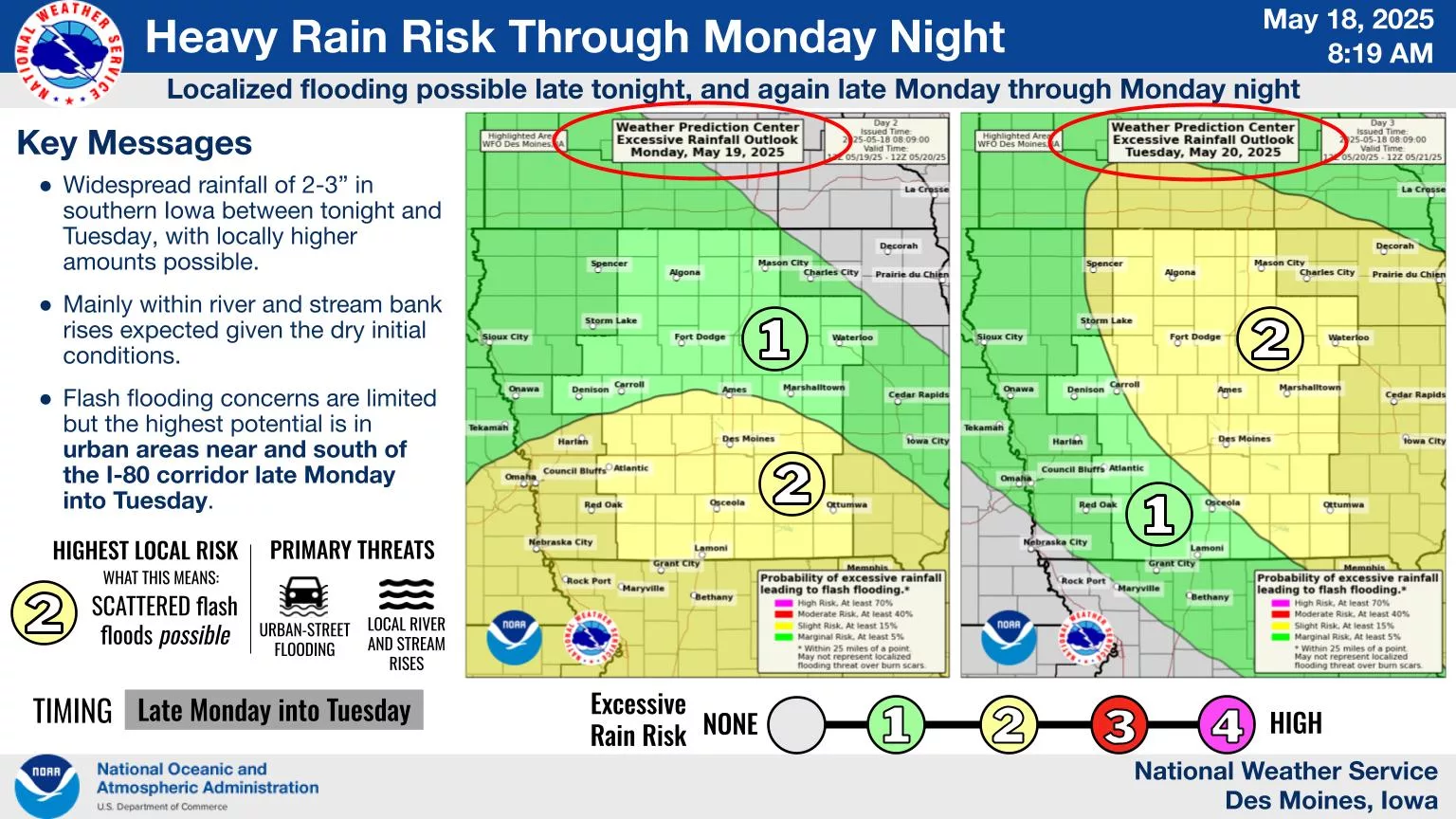
A lengthy local dry spell will give way to multiple rounds of rainfall early this week, with chances increasing for both severe weather and localized flooding.
According to the National Weather Service, a slight risk of severe weather and excessive rainfall is in place, spanning from Monday evening into early Tuesday morning. Most locations are expected to receive at least an inch of rainfall, and up to three inches is possible in isolated locations, depending on the track and timing of thunderstorms.
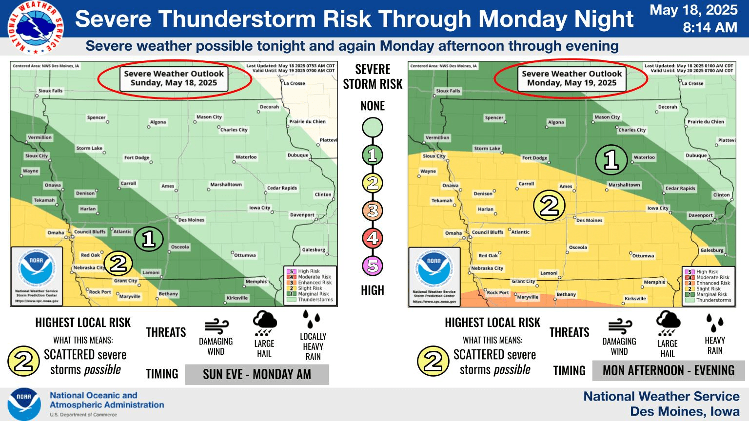
The severe threat will include large hail and damaging winds, primarily Monday evening.
The KNIA/KRLS Severe Weather Action Team is on the air with live coverage of any severe thunderstorm or tornado warning in Marion, Warren, and Jasper Counties.