
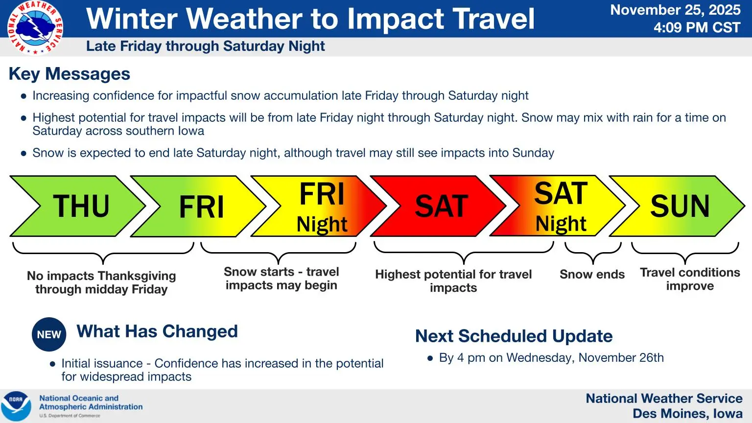
Colder temperatures will open the door to a potentially wide range of winter weather impacts over the next several days. According to the National Weather Service, chances continue to increase for impactful precipitation starting late Friday and continuing through Sunday morning. While exact snowfall totals will be harder to define, expectations are increasing for impacts on travel, especially during one of the busiest weekends on the roads throughout the year. Regardless of the final amounts, snow and ice will likely impact at least some travelers starting Friday afternoon, with multiple rounds of precipitation possible through Sunday morning. City, county, and Iowa DOT plows will likely be in operation starting Friday and continuing through Sunday morning. Drivers are reminded to give those workers extra space. Local snow emergency ordinances may also go into effect, so those planning to park in designated areas for plow operations are reminded to check their city’s respective laws ahead of this weekend. While colder air has arrived, bitter wind chills are expected to follow the snow system late Sunday into Monday. Wind chill values as low as five to ten degrees below zero are possible by Monday morning. Stay tuned to KNIA/KRLS Radio for cancellations and delays of local events this weekend and for updates on local road conditions throughout the possible winter storm.