
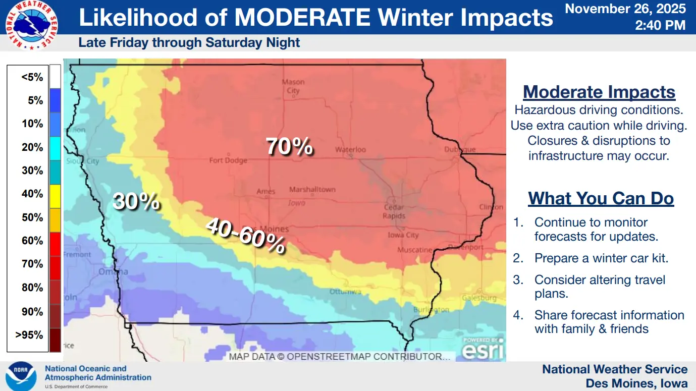
Travel impacts on all local and state roadways are expected with the first major winter system of the 2025-26 season following the Thanksgiving holiday.
Moderate to heavy snow is in the forecast to start mainly after sunset on Friday, with conditions worsening into most of the day Saturday.
According to the National Weather Service and Iowa DOT, travel will be difficult, and at times, dangerous across most of the state, especially in northern and eastern Iowa. The vast majority of Iowa communities are expected to receive at least four inches of snowfall by Sunday morning, with many topping eight inches or more.
Locally, a mix of rain may lower snowfall amounts, but driving will still likely be difficult for many. Those who need to travel are encouraged to give city, county, and Iowa DOT plows plenty of space to operate. Several snow ordinance emergencies are also expected in all local cities — meaning vehicles need to be moved from designated routes for clearing.
While conditions will improve in terms of precipitation by Sunday, much colder conditions will settle into the region. Wind chill values below zero are likely, especially early Monday and Tuesday morning.
Stay tuned to KNIA/KRLS for cancellation and delay information, road conditions, and Weatherology forecasts.