
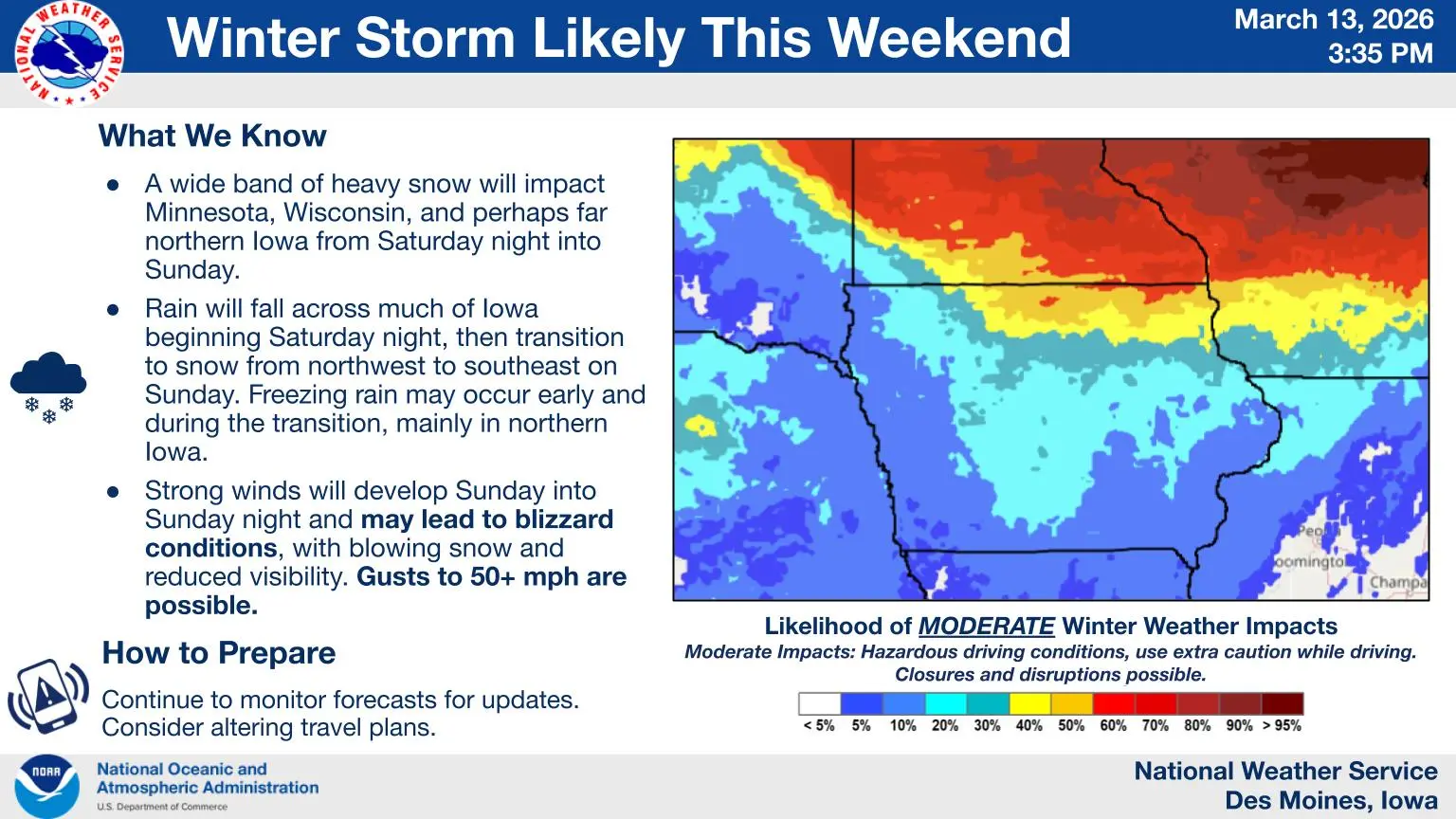
As many people hit the roads and have flights ready for Sunday ahead of spring break for several area schools, a late-season winter system could make travel difficult for many.
According to the National Weather Service, strong winds return to most of Iowa on Sunday afternoon, and with it, rain will likely switch over to snow. Final accumulations will vary, based on the timing of the temperature change. High temperatures will be in the 50s early in the day and drop nearly 30 degrees by midnight.
Regardless, wind gusts up to 50 MPH could cause blizzard-like conditions in some areas, even in those where snow accumulations are on the lower end. Breezy winds will start Sunday afternoon and continue through late Monday morning.
Wind chill values will dip between 10 to 15 degrees below zero on Monday morning. Colder conditions will continue through Wednesday morning.