
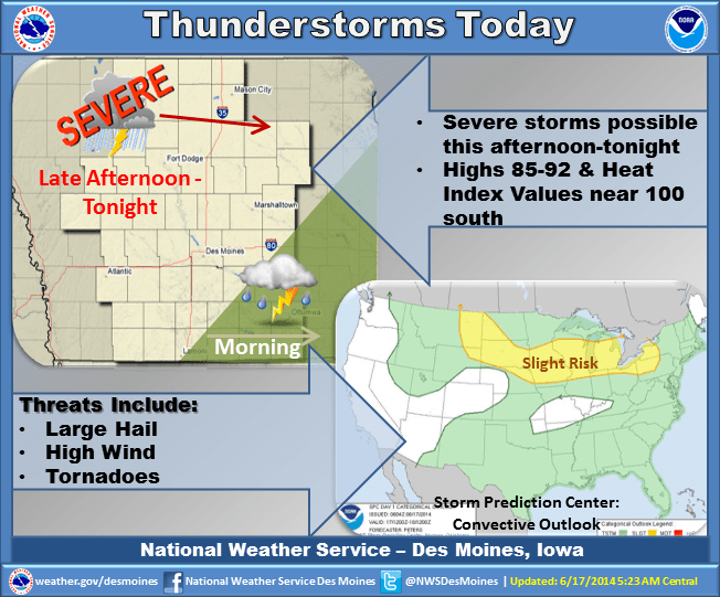
After today’s early morning round severe thunderstorms, more are in the forecast. The National Weather Service Storm Prediction Center has issued a slight risk of storms for Marion County through Thursday morning. The next two rounds are expected during the late tonight into early Wednesday morning and again Wednesday night into early Thursday morning. The biggest threats over the next 48 hours include strong winds in excess of 70 miles per hour, torrential rainfall, and large hail. The KNIA/KRLS Severe Weather Action Team is on alert and monitoring the developing weather situation.