

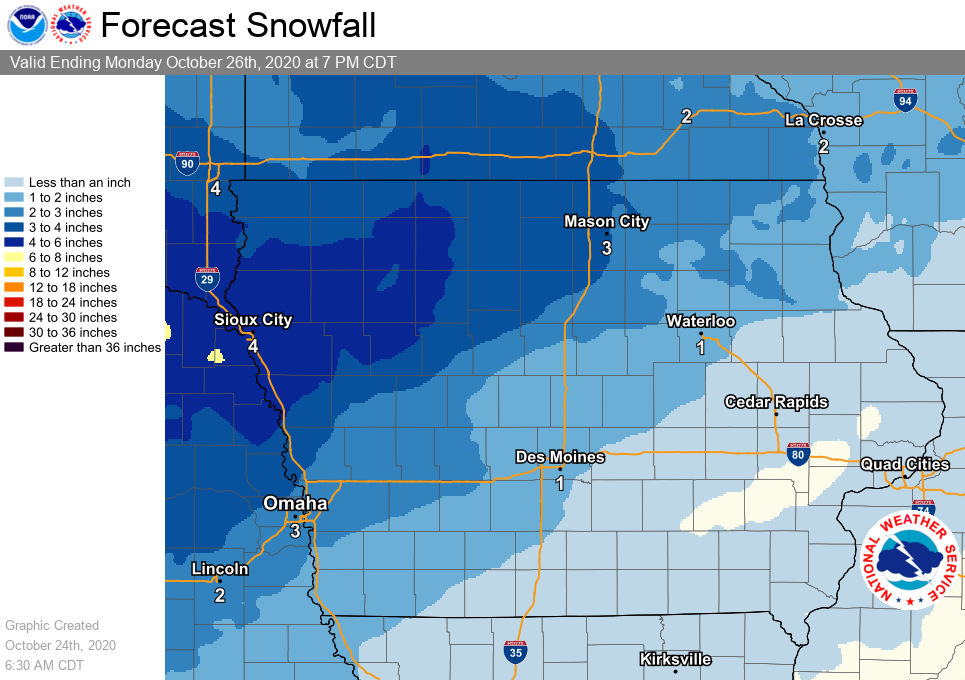
Snowfall moves into the state Sunday and Sunday night as a large low pressure system drops south through the Rockies and Plains states. The highest totals are expected over the northwest third of Iowa where amounts of 3 inches or more may occur. Expect the snowfall to produce areas of hazardous travel conditions, especially as temperatures begin to fall late in the day. Further south and east, warmer temperatures near to above freezing may favor some periods of light rain which would cut into potential snowfall amounts. The temperature forecast remains somewhat uncertain, and the difference of just a few degrees would have an impact on snowfall amounts.
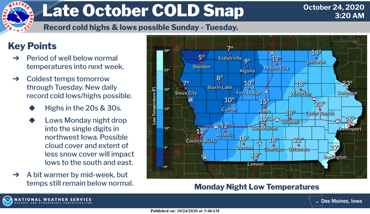
A period of well below normal temperatures will continue into next week across the state of Iowa. The coldest stretch will be Sunday through Tuesday when some areas may see daily cold temperature records broken, including Monday night when northwest Iowa drops into the single digits. Temperatures will warm a bit by the middle of the week, but still remain below normal.
Records (Marion County):
Sunday – coldest daytime high: 36 (1957); coldest low, 17 (1942); snow – 1.5″
Monday – coldest daytime high: 30 (1925); coldest low, 17 (1997)
Tuesday – coldest daytime high: 29 (1925); coldest low: 6 (1925)