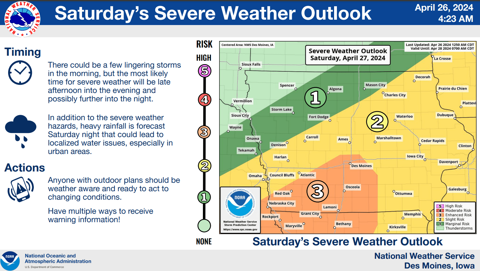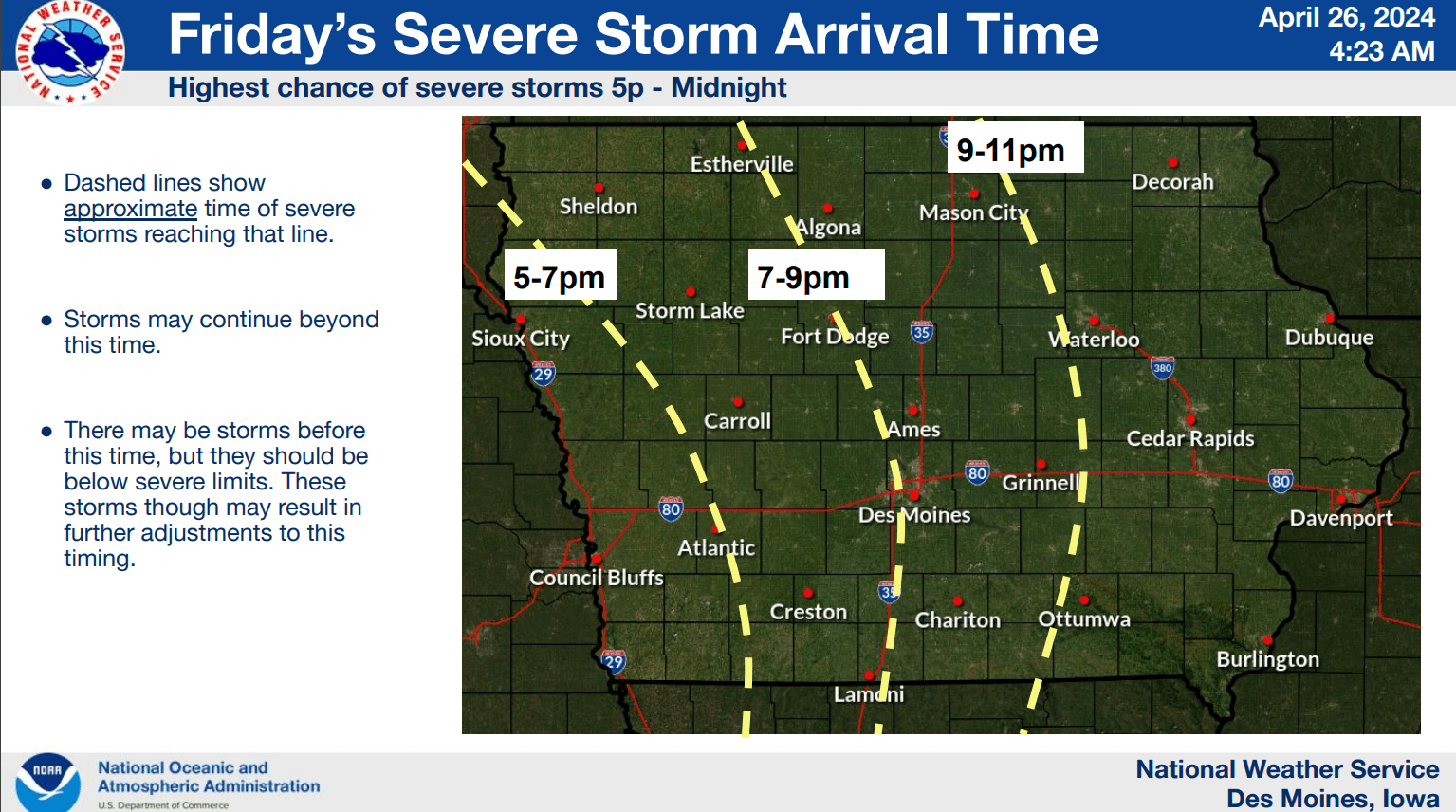

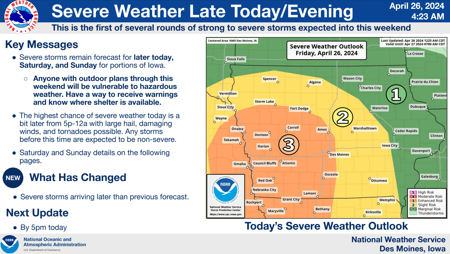
Multiple chances for severe weather remain in the forecast starting this evening and continuing through overnight Sunday. According to the National Weather Service, an active weekend includes several rounds of thunderstorms, with the best chances for large hail, damaging winds, and isolated tornadoes this evening and again later on Saturday. An enhanced risk (3/5 on the national scale) is in place both days locally, according to the National Weather Service Storm Prediction Center. Depending on the final track of the overall system, significant rainfall and localized flooding potential remains, as most of the region should receive at least two inches of precipitation by Monday morning, and likely more if several thunderstorms develop. The KNIA/KRLS Severe Weather Action Team is on the air with live coverage of any severe thunderstorm or tornado warning impacting Marion and Warren Counties.