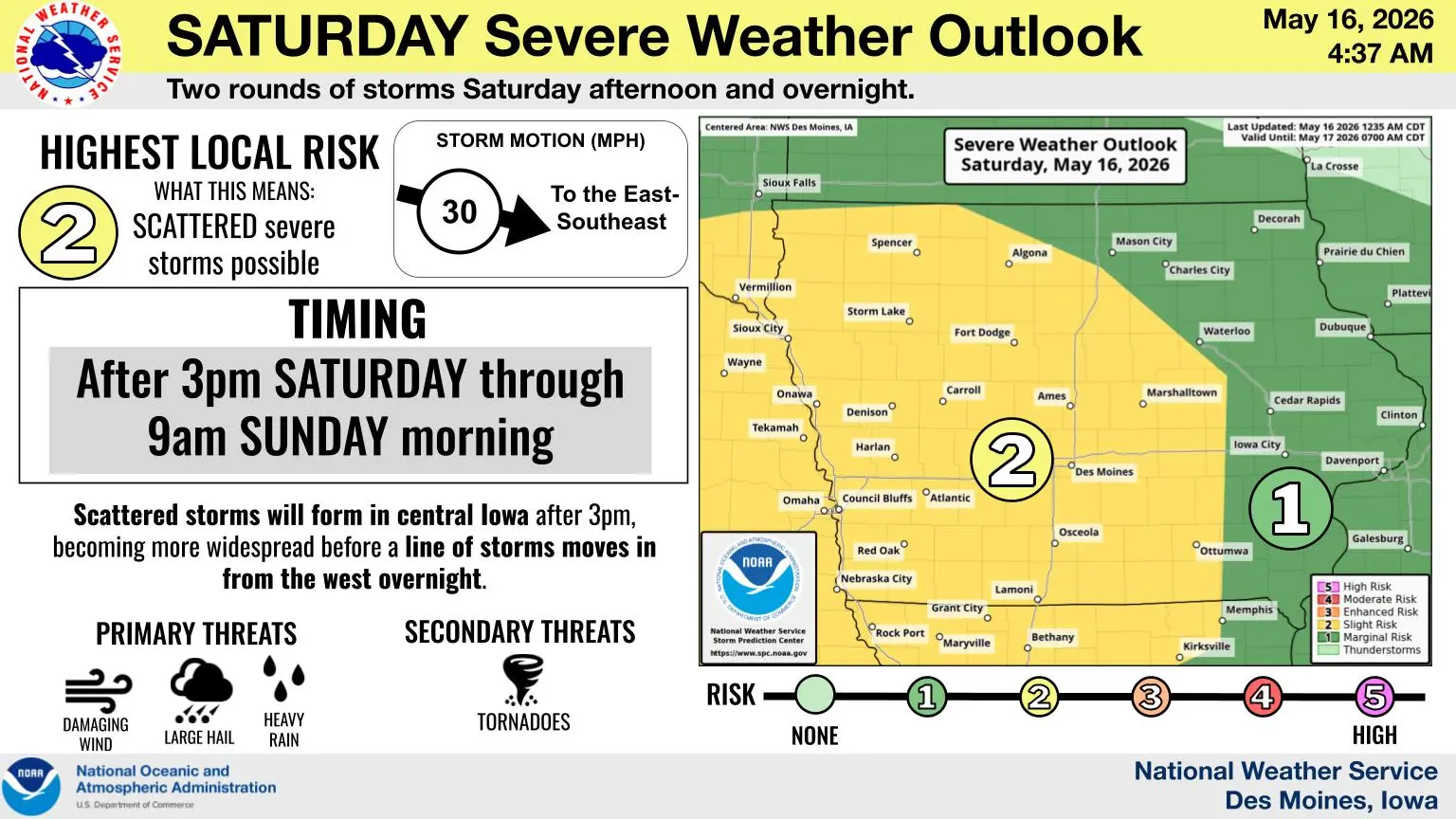
The severe weather risk continues today, with much of central Iowa under a Slight Risk (Level 2 of 5). Isolated storms will form over central Iowa Saturday afternoon before becoming more widespread. Overnight, a line of thunderstorms will move in from the west. Early on, large hail will be the primary threat before switching to damaging winds and heavy rain. A tornado or two cannot be ruled out early on.
The KNIA/KRLS Severe Weather Action Team was on the air for nearly an hour on Friday night for a warning impacting southern Warren County and southwestern Marion County, which included multiple updates from a Weatherology meterologist.